
SURVEYING & MAPPING
Surveying & Mapping comprises of various courses, which includes industry specific CAD software that are used by Civil Engineers or Surveyors for visualization and simulation tools thereby giving the stakeholders a better understanding of a site.
CAD software aids surveyors for streamlining projects and in evaluating multiple supposing scenarios. It helps in creating, annotating, moving, rotating, plotting and generating land surveying drawings quickly and easily.
Categories of Surveying
- Land Surveying
- Quantity Surveying
- Valuation Surveying
SURVEYING
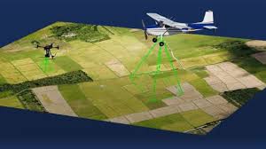
Land Surveying or Surveying is the science, technique, and profession which determine the 3D position of points, distances and angles between them. Surveyors mainly uses these equipment such as total stations, GPS receivers, robotic total stations, retro reflectors, 3D scanners, handheld tablets, radios, digital levels, drones, subsurface locators, GIS and surveying software.
Quantity Surveying:
The objective of the quantity surveying is to provide students with a practical base to enable them measure, value, cost and specify construction resources, and to become active players in the rational identification, utilization and control of resources within the construction industry.
Softwares used by Quantity Surveyors
- AutoCAD
- Revit
- PlanSwift
- Microsoft Project
Valuation Surveying
A Valuer is a professional who carries out inspections in order to help determine the current market value of property and/or land. The role of valuer can be undertaken by an estate agent or by an independent professional (often a qualified surveyor). Typically, they act on the instructions of a vendor (seller) or a lending institution who are considering funding the purchase.

Employments:
Land Surveyors with CAD skills are eligible to get employment in various sectors such as:
- Government Departments
- Infrastructure Companies
- Construction Firms
- Consultants for Civil Engineers
Professionals of Quantity Surveying are expected to gain employment
- Both the private and public sector Government Ministries
- Local Authorities, departments & parastatals
- Construction firms
- Private consultancy firms offering quantity surveying services
Responsibilities of a Valuer
- To conduct a property valuation known as a vendor survey
- To conduct structural surveys that assess its physical condition.
- To establish council tax and rating levels for local authorities
- To undertake residual valuation of land
Prespective Jobs:
Surveyors can look for the following job opportunities:
- Structural Design Engineer
- Structural Engineer
- Structural Designer
- Senior Land Surveyor
- Planning Engineers
- Survey Crew Chief
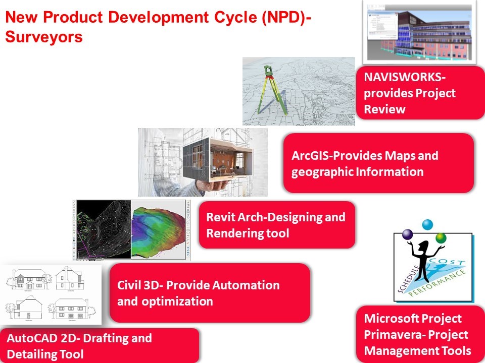
Courses offered at CADD Centre:
CADD Centre offers training on following courses for Surveying & Mapping